City Management
Illegal Construction Inspection, Personnel Management, Fire Inspection
Real-time monitoring through computers, tablets, mobile phones and other terminal devices anywhere
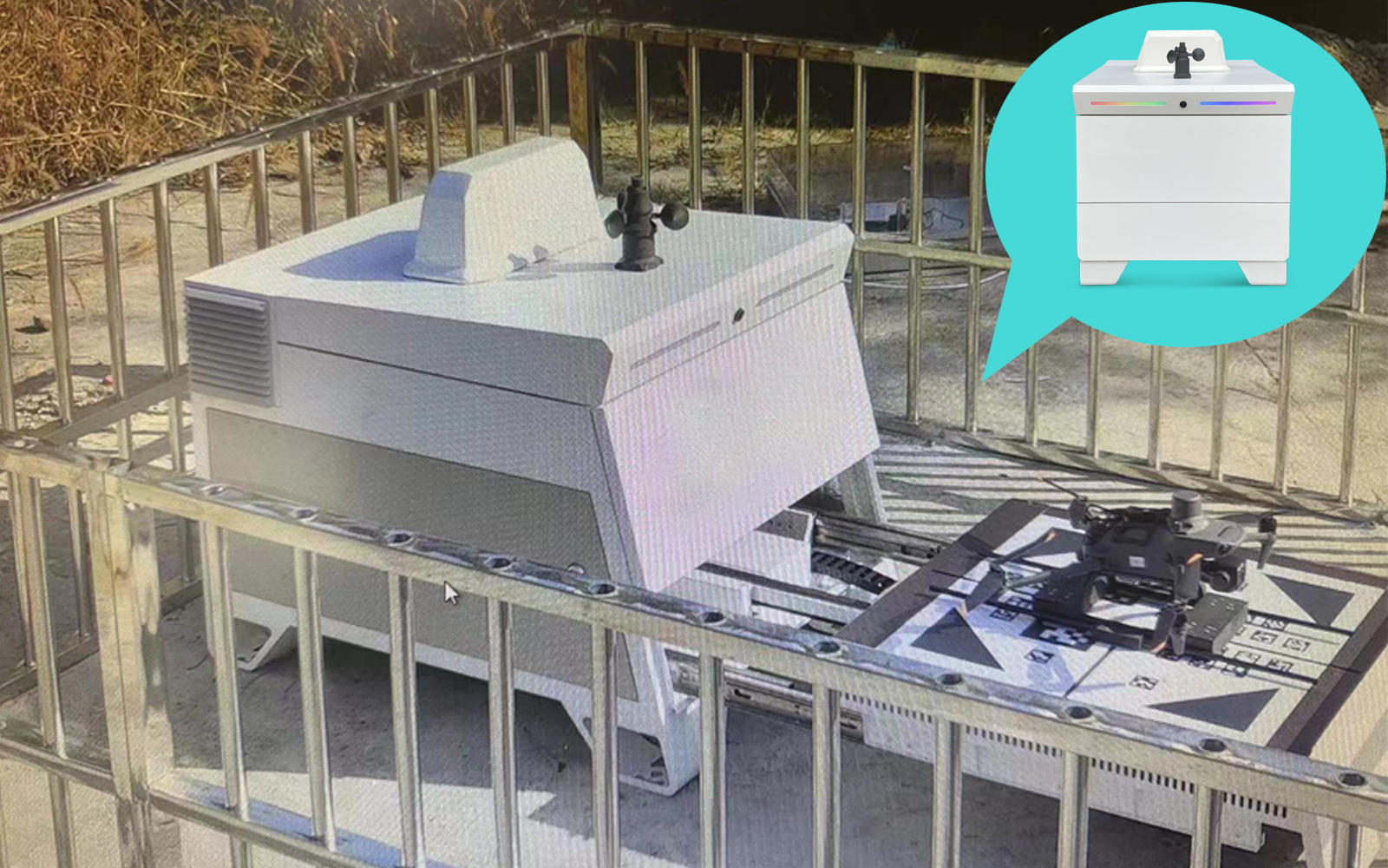
Realize automatic storage, automatic charging or battery replacement, automatic download of existing data
Adapt to DJI UAVs, realize automatic driving, and support 4G/5G communication
Cooperate with excellent industry companies to use artificial intelligence technology to complete data analysis
| Main Module | Submodule | Function Description |
|---|---|---|
| Task Function | One-click dispatch of inspection tasks | Remotely start the drones in the automatic airport with one key through the network to perform the set flight inspection tasks. |
| Route upload and download | Support uploading and downloading of routes in KML format | |
| Route preview | Preview routes and actions on the map, such as photo points, start and stop video points | |
| New task | Support for new flight missions | |
| Modify tasks | Support for modifications to established flight missions | |
| View tasks | Including task name, task description and other information | |
| Perform tasks | Support one-key task start | |
| Route detection | Estimate the flight time of the current route, the number of photos, the flight mileage and other information | |
| Drone Control | Check before takeoff | Detect battery power, battery temperature, rainfall forecast, disaster warning and other information before takeoff |
| Real-time video return | Adopt low-latency scheme | |
| Video playback backup | Support the automatic backup of the video sent back by the drone, and automatically erase the earliest record when the maximum capacity is exceeded | |
| Drone status | UAV's working status, flight mode, flight duration, flight speed, battery power, battery cycle times, battery temperature, flight altitude, signal strength, number of GPS satellites searched, and system operation logs, etc. | |
| Virtual joystick | Analog remote control push rod, real-time remote control of the drone | |
| Point and Fly | The position can be specified in the track display map, and the drone can be controlled to fly to the specified point | |
| Drone Control | PTZ control | Can take over the gimbal at any time and control the angle of the gimbal remotely |
| Track display | Display the track of the flight route on the map, support the clearing of the displayed track, and support the adaptive display of the track | |
| Advanced Control | It can realize hovering, termination landing, precise landing, etc. | |
| Debug interface | Command line debugging possible | |
| Real time monitoring | It can monitor the airport in real time, the monitoring screen can be full screen, can display real-time video time, and support night monitoring | |
| Automatic Airport Control | Surveillance video backup | Supports automatic backup of airport surveillance video, and automatically erases the earliest records when the maximum capacity is exceeded |
| Weather monitoring | Optional local meteorological data measurement display, support network big data weather forecast (need to connect to an external network) | |
| Charger status | Can display battery charging status, including battery charging voltage, current, power and other information | |
| Sensor status | Can display the location information of each location sensor in the airport | |
| Advanced Control | It can open/close the hatch, release/fix the aircraft, start/stop charging, etc. | |
| Data Storage and Viewing | Automatic data download | After the drone lands, the system automatically downloads the original data, including photos and videos, and displays the download progress |
| Data storage | Provide 2T storage space by default, save it locally | |
| View data locally | Save data by date, videos and photos will be automatically transcoded for remote preview viewing | |
| Secondary Development | Data extranet view | Support the use of external network to remotely access data stored locally |
| API secondary development interface | Provide API secondary development interface | |
| Secondary Development | MQTT protocol interface | The real-time status interface of drones and hangars based on MQTT protocol can be networked with IoT devices using the same protocol, and supports a unified JSONRPC interface |
Illegal Construction Inspection, Personnel Management, Fire Inspection
Security Inspection, Equipment Management
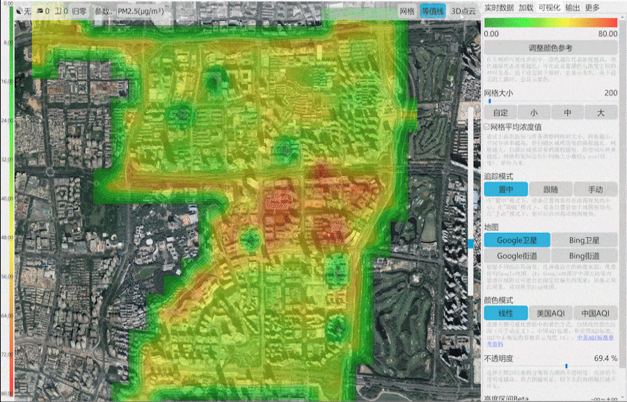
Sewage Discharge, Garbage Identification, Flood Season Inspection
Process Documentation, Construction Safety Inspection, Asset Management
Fire Inspection, Disaster Relief, Personnel Monitoring
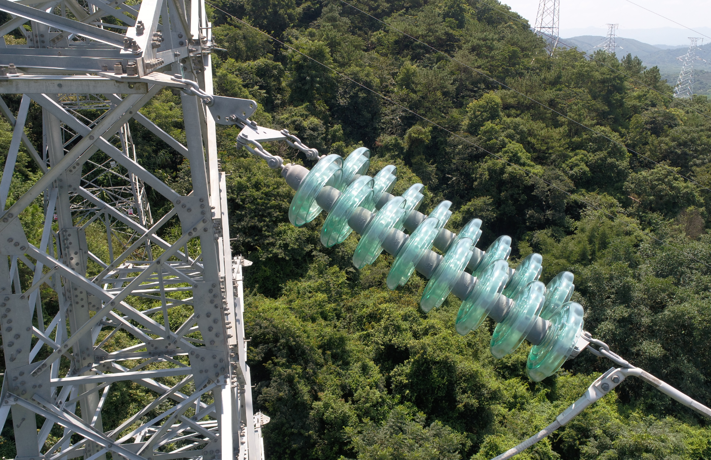
Transmission Lines, Tower Inspection, High Temperature, Power Station Inspection
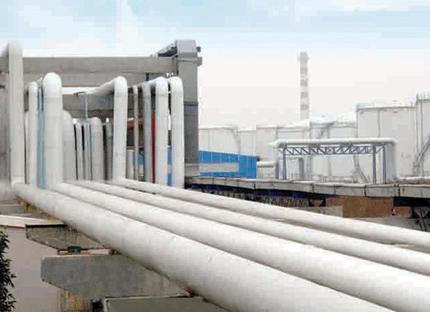
Plant Inspection, Gas Monitoring, Pipeline Inspection, Equipment Inspection
High-definition zoom camera + infrared camera, which can be automatically inspected or manually taken over, automatically monitor the operation status of oil and gas fields and pipelines, understand the surrounding environment in time, and escort production.
Widely deployed for transmission lines, substations, towers and other power facilities automation inspection, achieving high temperature detection, fault warning and other functions.
Applied to base station management, oil and gas pipelines, public security monitoring, emergency response and other fields, covering electricity, power stations, natural resources, ports, smart cities, public security and other industries.
The drone automatically takes off from the dock
The drone automatically lands in the dock
CHATGPT automatically generates inspection reports from patrol videos.